Green Infrastructure Plan
About
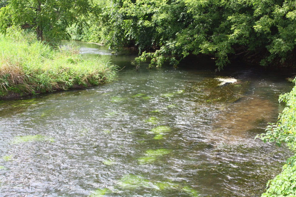
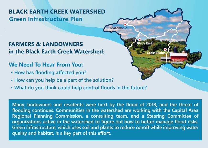
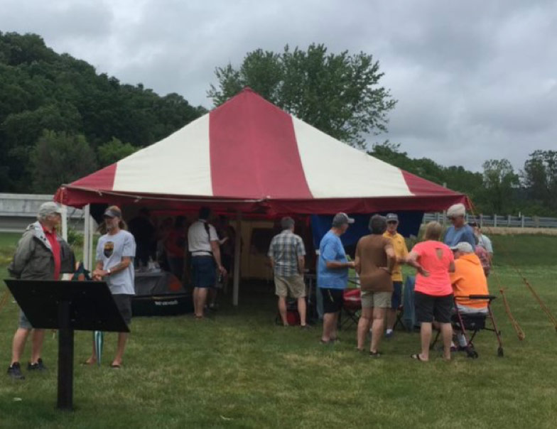
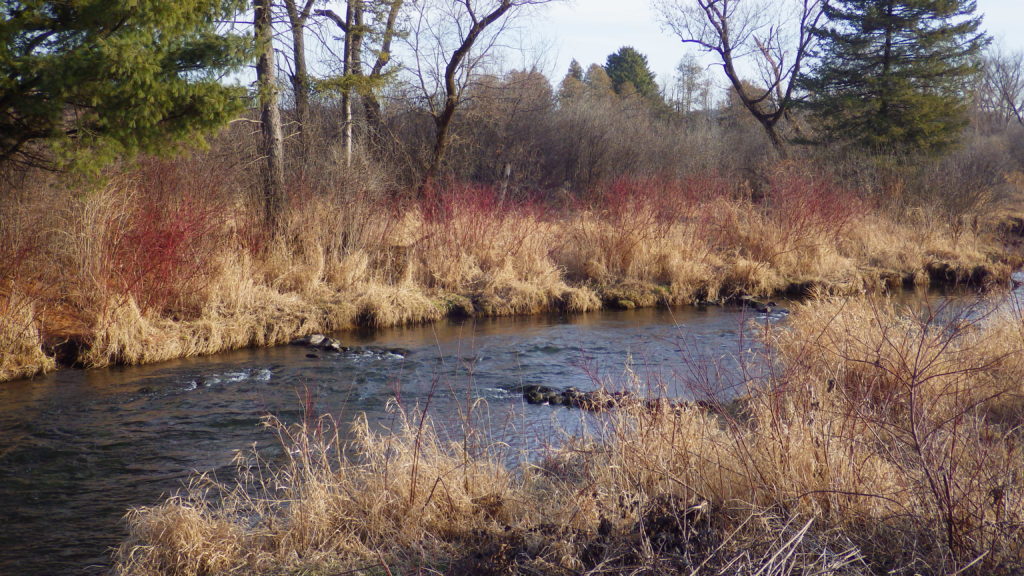
Communities, businesses, and farms surrounding Black Earth Creek were hit hard by flooding in August 2018. Black Earth Creek is a high-quality cold-water trout stream just west of Madison, Wisconsin that flows through three villages, across farmland, and attracts recreationists for fishing, kayaking, and other activities.
Silvernail Geodesign was part of a team working with local partners and communities to identify where we can best locate green infrastructure practices, or landscape features to catch rainwater where it falls, to be most effective at improving flood resiliency and enhancing water quality.
What we did
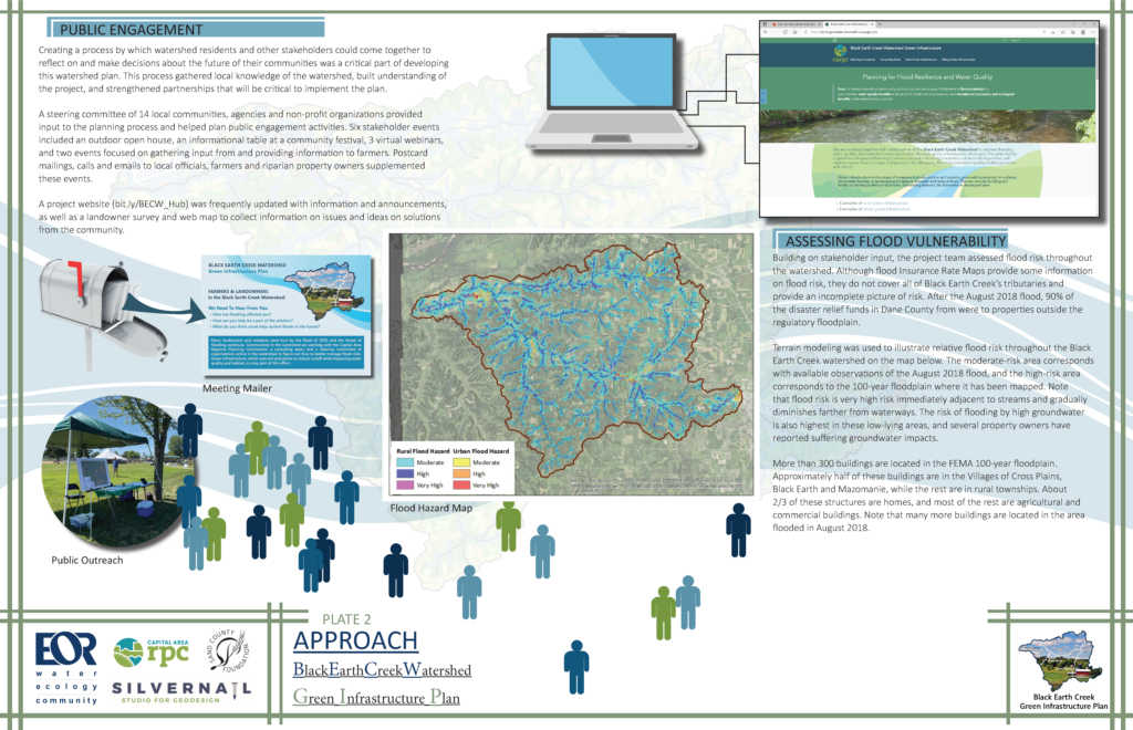
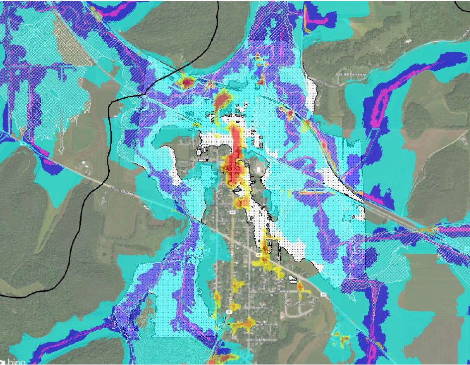
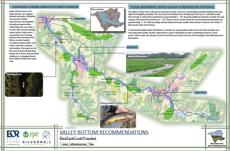
We developed strategies to locate green infrastructure features within the watershed using modeled flood risk maps and community input. We categorized strategies into 3 types of area: Valley Bottoms, Rural Uplands, and Urban Areas.
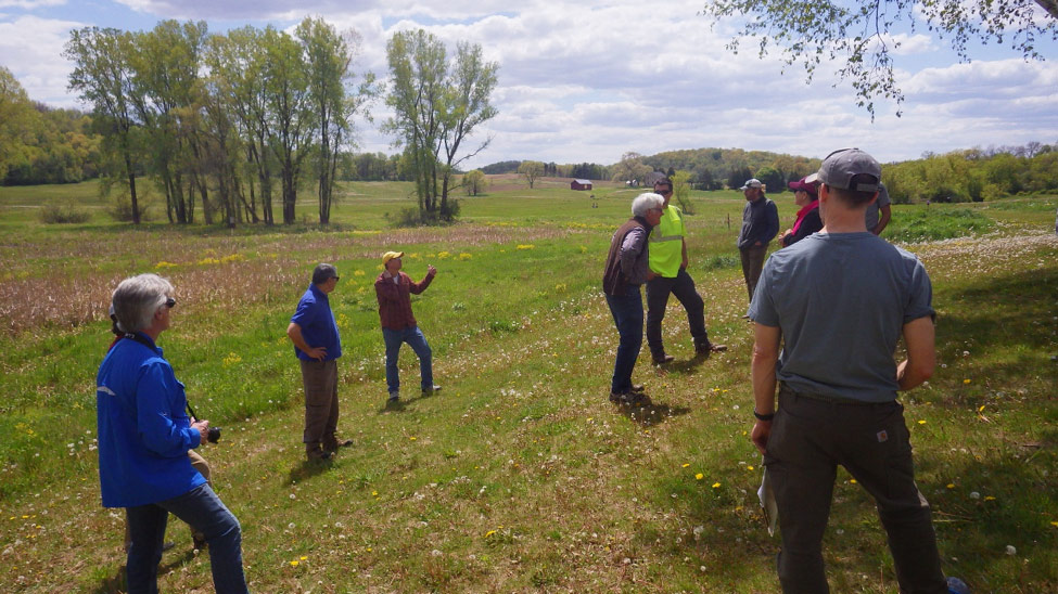
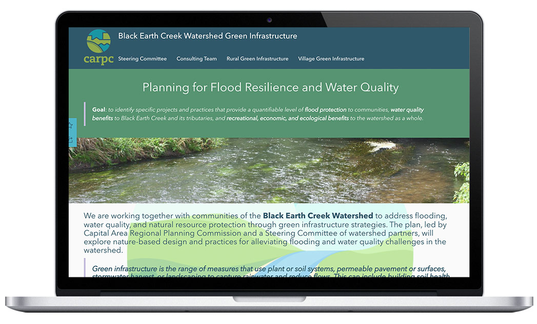
To foster collaboration and community engagement in the project, Silvernail built an ArcGIS Hub Initiative. Hub allowed us to share maps, events, and other content, and invite community followers to provide feedback in the process. As the project progressed, we added an interactive web app inviting community followers to add locations they thought would be good for green infrastructure. At the close of the project, we transferred the Black Earth Creek Watershed Green Infrastructure Plan Hub Initiative to the client as a final deliverable. The Hub site will live on as a dynamic reference on the client’s web site.
Client
Capital Area Regional Planning Commission (CARPC)
https://www.capitalarearpc.org/
Tools Used
ArcGIS Hub
Esri Survey123
ArcGIS Online
ArcGIS WebApp Builder
ArcGIS Pro
Working with local partners and communities to identify where we can best locate green infrastructure practices.